I should have used that fancy "markup" thing that MacOS has, but this is pretty easy.
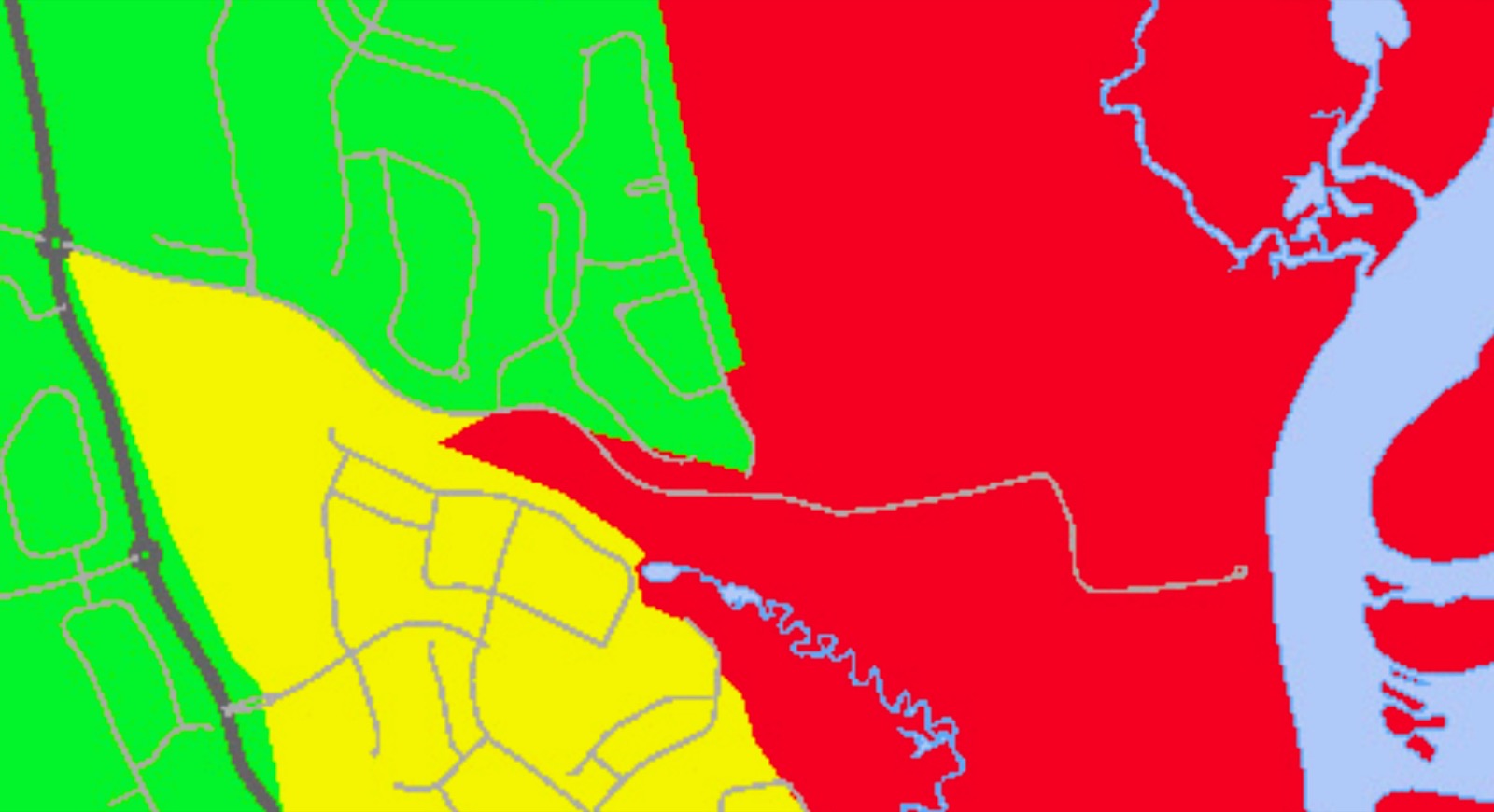
Red is Zone A. Green is Zone D. (Yellow is Zone C. I initially wrote that my neighbor across the street was in Zone C. Nope. Zone D. D!!!)
Anyway, see that corner down there where green kind of stabs into the red? That's where I live. That bit of gray road that forms a loop? That's Wood Pond Loop. The south end of Wood Pond Loop, where there's another, fractal, little corner of green marrying up to the red? That's the point where the houses on our side of the street become part of ZONE D!
Despite being backed up to the same swamp that we are!
So, yeah, we're not going anywhere. If we have to, we'll go knock on our neighbor's door.
✍️ Reply by email
Originally posted at Nice Marmot 17:25 Tuesday, 8 October 2024